Updates to the Cycling Open Data portal make it even easier to see the positive impact of networks of dedicated cycle lanes.
Whether you're a planner, researcher or a member of the public looking to discover more about the latest cycling data in your area - the Cycling Open Data portal may be able to help.
The portal is available for anyone to use and brings together the most comprehensive collection of active travel data of its kind in Scotland, in partnership with local authorities and other active travel organisations. From real-time data supplied by a nationwide network of more than 800 automatic cycle and walking counters, to biannual traffic surveys giving snapshots of all travel behaviour on streets and roads across Scotland, through to information on Bikeability Scotland delivery, Scottish Household Survey findings on transport habits and much more.
Recent updates to the portal include:
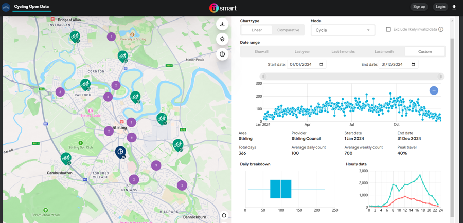
- An improved interactive map, linking to real-time data (green) and data from biannual traffic surveys (dark blue).
- The ability to display cycling and walking counter data from a specific time frame.
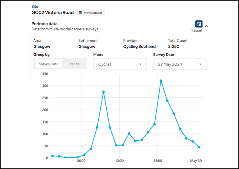
- New, easy-to-read graphs breaking down traffic survey data into each mode of travel, hour by hour.
- Displays of average counts over a 24-hour period, with breakdown of what percentage of counts is recorded during peak travel times.
- A rolling ticker of the best performing count sites in Scotland.
- Summaries of national walking and cycling data.
- Pop-ups with guidance for first time users.
What can we learn from the data, and why is it important?
At its core, the Cycling Open Data portal is designed to support research, policy and decision making at all levels by providing clear data to make evidence-based choices. With partners and users also able to upload their own data to the portal, its open and collaborative approach means it will continue to evolve and grow in utility into the future.
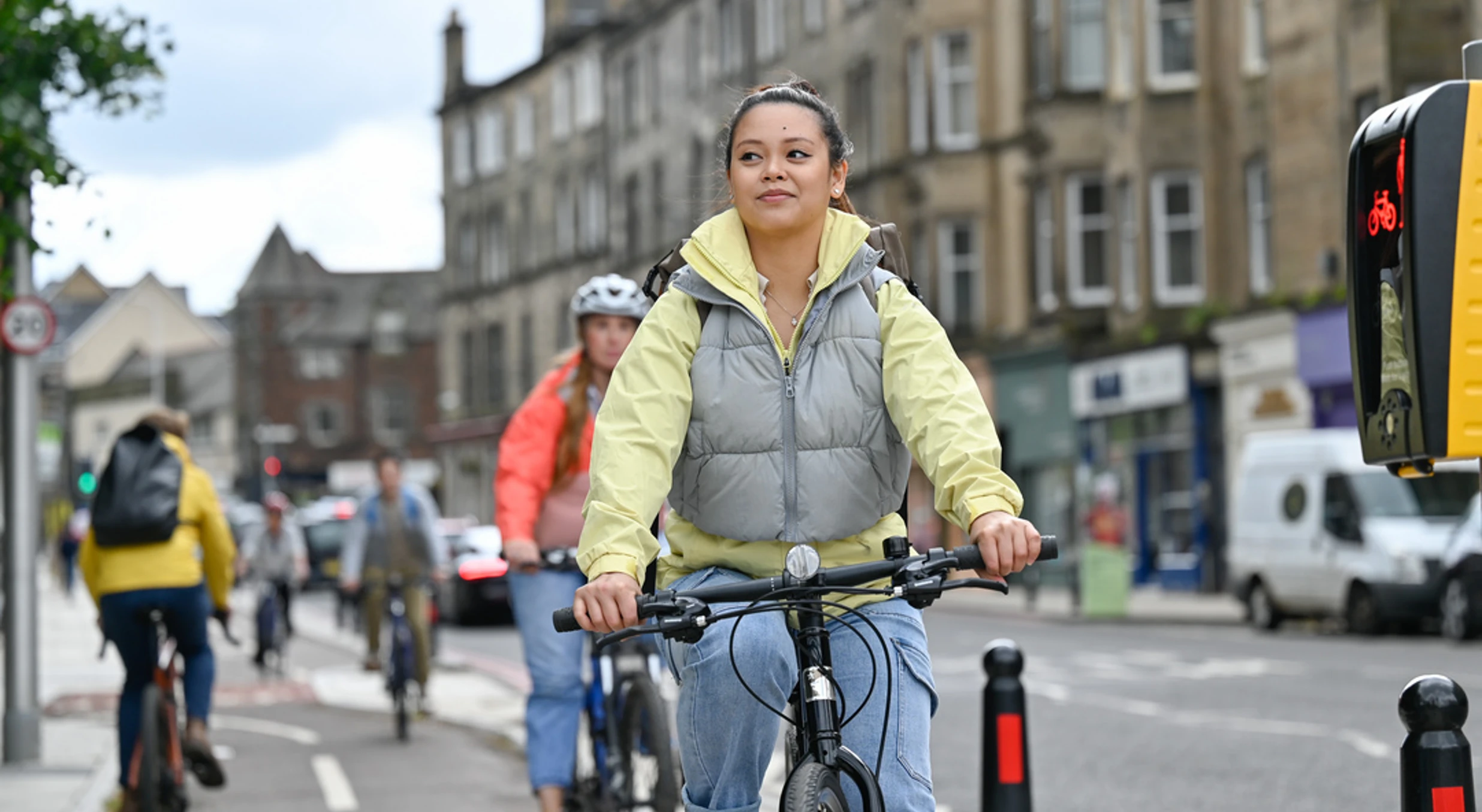
What’s clear from data published on the portal to date, is that where national and local investment in safer, dedicated cycle routes has gone in - from the CCWEL and Leith Walk in Edinburgh, to the South City Way in Glasgow or around Stirling's growing city-centre cycling network - we are now beginning to see massive increases in cycling at a local level.
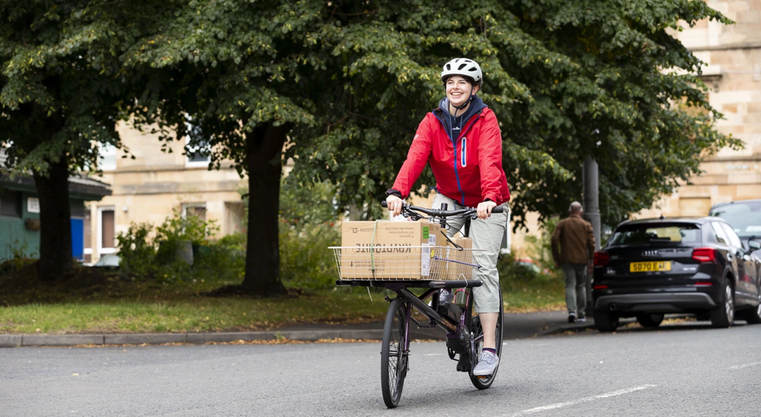
On top of this, new, easy-to read graphs that show hourly data from automatic cycle counters and traffic surveys – managed in partnership with local authorities and other organisations – mean the portal now offers even deeper insights into how new cycle routes are being used. With peaks in activity clustered around morning and evening rush hours, it’s evident that new dedicated cycle lanes are helping people to make everyday journeys by bike, like commuting to and from work.
If you're keen to find out more about cycle rates in your local area, why not explore the Cycling Open Data portal for yourself.